Kenya is one of the most meteorologically complex flying environments in the world. You have the Indian Ocean coast generating sea breezes and humidity. You have the Great Rift Valley channelling winds and creating mechanical turbulence. You have the Central Highlands generating thunderstorm activity most afternoons during the rainy seasons. And you have the semi-arid north: clear skies, extreme heat, and thermals that can rattle a C172 from 1,000 ft to 3,000 ft without warning.
None of this is reliably captured in the official weather products available to a private pilot planning a cross-country flight. Understanding the limitations of Kenyan aviation weather, and building a usable weather picture despite those limitations, is a competency that separates safe Kenya-based pilots from those who have incidents.
What the official weather products cover
Kenya Meteorological Department (KMD) and the Kenya Airports Authority (KAA) produce aviation weather for the country. The coverage is anchored on the major international airports:
- METAR/SPECI: Available for HKJK (Nairobi/JKIA), HKMO (Mombasa), HKKI (Kisumu), HKEL (Eldoret). Wilson (HKNW) produces METAR but it is essentially the same measurement point as JKIA.
- TAF: Available for HKJK, HKMO, HKKI, HKEL, issued every six hours.
- SIGMET: Issued for significant en-route weather (thunderstorms, severe turbulence, volcanic ash where relevant).
- PIREP: Pilot weather reports, infrequent but valuable when available.
For a flight from Wilson to Nanyuki, you have official weather data for Wilson/Nairobi at the departure end and nothing official for Nanyuki or anything in between. The 130 km of terrain crossing the Aberdares is entirely uncovered by official reporting.
Building the picture from non-official sources
Experienced Kenya pilots do not rely solely on official weather. They use a layered approach:
Satellite imagery. Free satellite loops (particularly infrared and visible channel composites) show cloud build-up over the highlands in near-real-time. Cloud over the Aberdares in the late morning often means convective activity by early afternoon. Reviewing a two-hour satellite loop before a highland routing is not optional for responsible planning.
Phone calls. This sounds archaic but remains the most reliable source of strip weather for private and concession aerodromes. The caretaker at Lewa Conservancy can tell you whether the strip is usable and what the sky looked like in the last 30 minutes. The camp manager at Samburu knows if there are afternoon thunderstorms building over the escarpment. Build relationships with the people at your regular destinations.
Pilot reports from the route. Other pilots who flew the route in the preceding few hours are your best source of turbulence, cloud base, and visibility data. Your flight school's operations desk, other schools at Wilson, and the charter operators on the common frequency all generate PIREPs informally. Listen and contribute.
Wind gradient and terrain analysis. Once you know the METAR surface wind at Nairobi and you know the forecast upper wind from the AIRMET/SIGMET products, you can estimate what the wind is doing over the terrain. The Rift Valley escarpment with a easterly surface wind and a westerly upper wind creates rotor activity in the valley. This is not in any forecast product: it is derived from basic meteorological knowledge applied to known terrain.
Kenya's two rainy seasons and what they mean for VFR flight
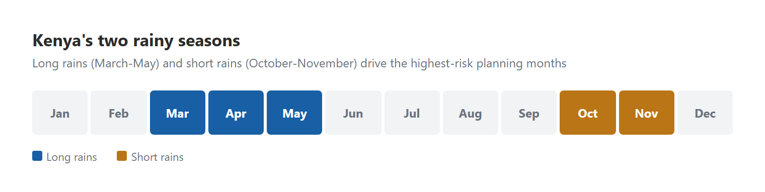
Kenya has two main rainy seasons: the long rains (March to May) and the short rains (October to November). Student pilots trained entirely in the dry season (June to September and December to February) are sometimes caught out when they encounter the realities of rainy-season VFR flying.
During the long rains:
- Cloud base at Wilson can drop to 1,200–1,500 ft AAL on overcast days, reducing circuit safety margins significantly
- Convective activity over the highlands typically initiates by midday and reaches thunderstorm intensity by 14:00–15:00
- Visibility in rain can be 3,000 m or less over the highlands, which approaches IMC for VFR flight
- The Rift Valley fog layer forms rapidly after rain and can completely obscure the valley floor within 20 minutes
The correct response to rainy-season uncertainty is aggressive preflight planning and conservative continuation criteria. Define your personal weather minima before departure, not in the cockpit when you are already airborne over the Aberdares and cloud is building. Typical personal minima for a student pilot on a highland cross-country: ceiling not less than 2,000 ft AAL above terrain, visibility not less than 5 km, no convective activity within 20 nm of planned route.
The continuation bias problem
Aviation psychology has thoroughly documented continuation bias: the tendency to continue into deteriorating conditions because the pilot has already committed to the flight, invested time and fuel, and does not want to turn back. Kenya's marginal weather and sparse aerodrome network make this bias particularly dangerous.
The antidote is the pre-departure "what will I do if" exercise. Before you depart for Garissa (HKGA), with its arid north approach and limited diversion options, ask yourself explicitly:
- What will I do if I encounter cloud below my minima at the halfway point?
- What is my nearest suitable diversion and do I have enough fuel to reach it from the worst point on the route?
- What will I do if I cannot raise Garissa radio when I am 30 minutes out?
If you cannot answer each of these questions with a specific, actionable plan before departure, you are not ready to depart. The answers belong in your PAVE assessment under the Environment and External pressures categories, and your instructor should be reviewing them.
The evening decision: when to accept and when to divert
Kenya's afternoon convective cycle is predictable enough to plan around. Most experienced pilots flying the highlands avoid departing any highland aerodrome after 13:00 if there is any convective cloud in the area. The question you should be asking at 11:00 at your destination aerodrome (not at 14:30 when the cloud is already building) is: "Do I have enough time to complete this sector before conditions deteriorate?"
The decision to divert or overnight at a destination is not a failure. It is the correct application of aeronautical decision-making. The AngaBrief pre-flight system creates a documented record of the risk assessment you completed before you departed. If you made a good-faith decision based on available information and conditions deteriorated unexpectedly, that record matters. If you departed into known poor conditions, the record matters in a different way.