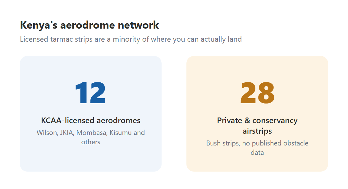
Kenya's aviation system includes 12 KCAA-licensed aerodromes (the tarmac strips at Wilson, JKIA, Mombasa, Kisumu, and their equivalents) and an additional 28 private, concession, and conservancy airstrips that operate outside KCAA licensing. These bush strips are the ones that make Kenyan aviation distinctive: carved into the Masai Mara, cut through highland tea estates, or laid along dry riverbeds in the arid north.
Student pilots are generally not authorised to operate from bush strips independently until they hold at least a PPL and have received specific type training for short-field and soft-field operations. But understanding what bush strips are, what they demand, and how the risk assessment differs from licensed aerodrome operations is core airmanship knowledge for every Kenyan pilot in training.
Why bush strips are operationally different
Licensed aerodromes have published dimensions, certified surfaces, obstacle clearance surveys, and regular inspection. Bush strips have none of these by default. What you typically have is:
- Approximate dimensions passed on by word of mouth or from bush pilot handbooks, and these dimensions often include displaced thresholds and obstacle zones that are not separately stated
- Surface condition that varies seasonally: what was firm murram in August can be soft laterite in April, with puddles shortening the effective runway by 30%
- No published obstacle data: the tree at the western end of Lewa's strip is known to experienced pilots and invisible to anyone approaching for the first time without a briefing
- No guaranteed ground handling, refuelling, or communication
- Wildlife on and around the runway, a fact of life at conservancy strips in the Mara, Samburu, Laikipia, and Tsavo areas
The pre-arrival information you must gather
For any bush strip you have not operated from before, minimum pre-arrival information includes:
Strip dimensions and orientation. Length in metres (not feet, most Kenyan strips are measured in metres). Width. Runway heading. Elevation above sea level: critical for density altitude calculation.
Surface type and current condition. Murram, laterite, grass, gravel, or dirt? What is the current condition? Have there been recent rains? Is there standing water? This requires a phone call to the destination, always. Do not rely on database information for strip condition.
Obstacles. What are the elevation and position of obstacles at each end? Trees, termite mounds, and undulating terrain at the threshold are common. Every strip has a local briefing item. Ask for it explicitly.
Traffic and circuit pattern. Bush strips often have preferred circuit directions dictated by terrain rather than the standard aerodrome circuit rules. At some Mara strips, the circuit is flown on one specific side regardless of wind to avoid terrain. Know this before you arrive.
Wildlife clearance procedure. Many conservancy strips require a low pass before landing to check for and disperse wildlife. Some require radio contact with the camp to have vehicles clear the strip. Know the local procedure.
Performance calculation is non-negotiable
The combination of short runway, soft surface, high elevation, and warm temperature at Kenyan bush strips creates density altitude conditions that make performance calculation mandatory rather than advisory. A strip at 5,500 ft elevation, 28°C on a warm afternoon, gives a density altitude of approximately 8,000–8,500 ft. On a soft murram surface, add 20–25% to the takeoff ground roll figure from your POH tables.
The practical consequence: strips that are perfectly adequate for a C172 in the cool of the morning become limiting in the afternoon heat. Pilots who depart a Mara strip at sunrise on the way in, and then attempt the same departure after a midday game drive, are operating in a significantly different density altitude environment. Plan the performance calculation for the actual conditions at the actual time of departure, not the conditions when you arrived.
As with any highland aerodrome performance calculation, work through your POH tables properly. Do not eyeball it. A 300 m strip that your aircraft can use in standard conditions may need 400-450 m in afternoon heat on a soft surface, which may exceed what is available.
The inspection pass
Before landing at any unfamiliar bush strip, a low pass at a safe altitude to inspect the surface is standard practice. The pass allows you to assess:
- Surface condition: puddles, soft patches, ruts, stones
- Wildlife presence: the landing runway must be clear, and animals disturbed by your pass often move off the strip before you turn final
- Wind sock condition: confirm wind direction if a sock is present
- Obstacles at the threshold and overrun area
- Any vehicles or people on the strip
The inspection pass is not optional because it seems professional. It is a safety procedure with a specific purpose: gathering information that cannot be adequately obtained at landing altitude. A low pass that reveals a pride of lions on the runway has prevented more than one catastrophic outcome.
Operating without ATC: radio procedures for bush strips
Most bush strips have no ATC and no mandatory radio frequency. The standard practice is to use the Unicom frequency (122.800 MHz) or the common traffic advisory frequency used in the area, and to make blind calls at key positions:
- 10 minutes out: announce your arrival, strip name, altitude, and intentions
- Overhead the strip for inspection: announce the inspection pass
- Downwind: announce position and intentions
- Final: announce final call and confirm clear to land if wildlife or camp has confirmed
Listen as well as transmit. Other aircraft may be operating in the area without the same equipment or communication habits you have. At busy Mara strips during peak season, several aircraft can be using the same strip within minutes of each other.
The AngaBrief Environment assessment for bush strips
The PAVE checklist Environment category covers aerodrome environment specifically. For a bush strip operation, your Environment assessment should document:
- Runway length and your calculated performance margins
- Surface type and confirmed current condition
- Density altitude at estimated departure time
- Known obstacles and clearance margins
- Wildlife clearing procedure at the destination
- Alternate aerodrome if the strip is unusable on arrival
If you cannot fill in each of these items with specific, confirmed information before you depart, you are operating with an incomplete risk picture. Your instructor (reviewing your assessment before you go) should be asking these questions. The discipline of filling in the assessment completely is what catches the gaps before they become incidents.