
Ask a Kenyan flight instructor about icing and you will probably get a shrug. "We're on the equator," the answer usually goes, "ice is someone else's problem."
That line is true on the ramp and dangerously wrong three thousand feet into the wrong cloud.
Why Kenyan training skips structural icing almost entirely
Most PPL and CPL ground school here spends real time on carburettor icing, because every C152 and PA-28 (Piper PA-28) in the training fleet needs carb heat discipline on every power reduction.
Structural icing, the kind that builds on wings, tail, pitot tube and windscreen rather than inside the engine, gets a sentence or two at most, usually filed under "not really a Kenya problem."
The reasoning is not unreasonable on its face. Nairobi sits roughly one degree south of the equator, Wilson rarely sees a daytime high out of the twenties Celsius, and nobody here is training for a Canadian winter.
But that reasoning only holds at the altitudes a normal lesson occupies, inside the air mass a normal lesson occupies. Step outside either assumption and the physics stops caring what latitude you are flying over.
What structural icing actually needs
The FAA's AC 91-74B, Pilot Guide: Flight in Icing Conditions, spells out the recipe plainly: visible moisture, and an airframe surface at or below freezing.
The US National Weather Service's icing training material puts the mechanism behind that recipe in one sentence: nearly all aircraft icing occurs in supercooled clouds, where water droplets stay liquid well below 0°C until an aircraft surface gives them something to freeze onto.
The FAA's aviation weather chapter on icing narrows the danger zone further. The AC 00-6A icing chapter states that the greatest concentration of supercooled liquid water sits in cloud between 0°C and -15°C.
Notice what is missing from that recipe. Nothing in it says winter, nothing in it says high latitude, it says cloud and temperature, and Kenya has both in abundance during its rainy seasons.
The clouds Kenya builds every wet-season afternoon
Kenya runs two rainy seasons, the long rains from March to May and the short rains from October to December, both driven by strong equatorial heating and high humidity feeding vigorous convection.
That same FAA icing chapter singles out cumulus built from vigorous convection as carrying unusually high liquid water content, which is exactly the setup for the fastest, heaviest clear ice an airframe can pick up.
SKYbrary's icing risk guidance makes the same point from the operational side: convective cloud is a recognised major source of in-flight icing, because its strong updrafts carry supercooled droplets higher and spread them through more of the cloud than a flat stratus layer ever would.
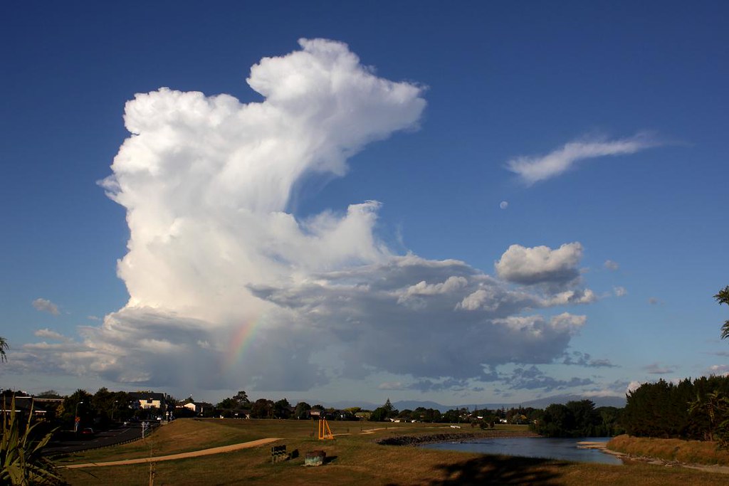
Every Kenyan student who has watched an afternoon buildup go from a lazy puff to a hard-edged tower over Kisumu, Nanyuki or the Rift Valley has watched exactly the cloud type this guidance is warning about. Most are taught to respect it for turbulence and lightning, almost none are taught to respect it for ice.
Where Kenya's freezing level actually sits
Here is the number that should change how you think about this. A peer-reviewed study of tropical freezing levels in Geophysical Research Letters places the freezing level across the tropics, roughly 20°N to 20°S, at about 4,800 metres, plus or minus 300 metres, for most of the year.
In round numbers that is about 15,750 ft, and it sits lower still inside a strong convective updraft, where rising air can pull the freezing band down faster than the surrounding atmosphere can warm it back up.
Now put that number against Kenyan terrain. Mount Kenya's summit stands at 5,199 m (17,057 ft), and the Aberdare Range's highest point, Mount Satima, reaches 4,001 m (13,127 ft).
A cross-country that climbs to clear high ground near either range, or a scenic transit that edges toward Mount Kenya's lower slopes, can sit at or above the freezing band without the pilot ever leaving Kenyan airspace or feeling especially adventurous. Add a building cumulus at that same altitude during the long or short rains, and every ingredient AC 91-74B lists is present at once.
What a little ice does to a trainer with no de-ice equipment
A C152, C172 or PA-28 training aircraft carries no boots, no weeping wing, no hot prop, and usually nothing more than basic pitot heat if you are lucky.
FAA AC 20-117 is blunt about what a small amount of ice does to a wing with none of that protection: roughness no thicker or rougher than medium or coarse sandpaper on the leading edge can cut lift by up to 30 percent and raise drag by up to 40 percent.
That is not a cosmetic change. It pushes the stall speed up, degrades climb performance at exactly the moment you need it to escape the cloud, and can block a pitot tube or static port and start feeding you unreliable airspeed when you can least afford it.
None of that is theoretical. The NTSB's safety alert on icing records an average of four structural-icing accidents and five fatalities a year in the United States between 2008 and 2021, in a country with far better icing forecasting, routine PIREPs, and a training culture that teaches icing as a known hazard from day one.
Kenya has none of that infrastructure and an aircraft fleet with less protection, flown by pilots trained to believe the risk barely applies to them.
A worked scenario: Nairobi to Nyeri in a September buildup
Picture a C172 on a dry-season-shoulder cross-country from Wilson to Nyeri, the kind of routing that passes close to the Aberdares on a day when the forecaster has not called for rain.
September sits outside both official rainy seasons, but isolated afternoon convection still builds over the highlands most days once surface heating gets going. The student sees one developing cumulus ahead near the route, well short of a thunderstorm, and decides it is small enough to skirt rather than divert around.
Skirting a small cumulus for turbulence reasons is a judgement call reasonable pilots make every day. Skirting the same cloud without asking whether its top reaches into the 0°C to -15°C band the FAA's guidance flags is a different decision entirely, because the icing risk does not scale with how threatening the cloud looks from outside.
The honest answer in that scenario is not "divert around every cumulus for the rest of your career." It is "know the freezing level for the day before you depart, and treat any cumulus near or above it as an icing question, not just a turbulence question."
How to actually check this before you fly
Kenya's METAR and TAF network, already sparse outside the main international aerodromes, does not report freezing level directly. You have to build the picture yourself from what is available.
Start with whatever upper-air temperature data your flight school's weather briefing already uses, whether that is a Kenya Meteorological Department upper-air chart or a free global model viewer with a temperature-aloft layer. Either will give you a usable estimate of where 0°C sits that day, which is the figure this article has been building toward.
Cross-check that estimate against the terrain on your route, specifically the Aberdares, Mount Kenya, and the Mau and Cherangani ranges if your routing touches them. If the freezing level and your planned altitude both land within a couple of thousand feet of high ground on a day with active convection, that is your cue to plan a lower route, a different time of day, or a different route entirely.
Finally, treat any pilot report of rime, mixed, or clear ice on your route the same way you would treat a PIREP of severe turbulence: as current, specific, and more reliable than any forecast. A PIREP culture barely exists in Kenyan general aviation, which is one more reason to be the pilot who files one and the pilot who asks for one before departure.
The decision rule, set before you ever need it
AC 91-74B's advice for an aircraft with no ice protection is not complicated: avoid known or forecast icing entirely, and if you encounter it unexpectedly, get out immediately rather than pressing on.
"Getting out" has an order of preference. Turn back toward the warmer, ice-free air you just came from before trying anything else, because retracing a route you know is clear beats guessing at one you have not flown.
A descent below the freezing level only works if the terrain underneath allows it, which near the Aberdares or Mount Kenya it frequently does not. Climbing through ice to reach warmer air above a layer is rarely realistic once a trainer has already lost 30 percent of its lift.
The planning version of this rule matters more than the airborne version, because an aircraft that already has ice on the wings has run out of good options. Check the freezing level on your pre-flight weather brief the same way you check cloud base and visibility, and treat any route that climbs toward high terrain during a wet-season buildup as a route that needs a specific icing answer, not just a general weather answer.
Instructors briefing a Nairobi-to-Nanyuki or Nairobi-to-Nyeri cross-country during the rains should name the freezing level out loud, the same way they already name cloud base and the Aberdares. A good CFI (Certified Flight Instructor) treats it as a standard item, not an exotic one.
What pilots say when the subject actually comes up
Icing barely exists as a topic on Kenyan pilot forums, and that absence is itself informative. When it does come up, the replies tend to split into two camps.
One camp answers quickly and confidently that icing is not a real concern here, usually citing the equatorial climate as if that settled the question at every altitude and in every cloud. The other camp, smaller and usually posting from mountain-transit or high-altitude experience, describes being caught off guard once by rime building on a strut or windscreen edge near a cumulus they had not expected to carry ice at that height.
Nobody in either camp frames it as a crisis, and this article will not either. What the pattern shows is a gap between confident folklore and the small number of pilots who have actually been there, and that is exactly the kind of gap a real hazard likes to hide in.
The Short Version
- Structural icing needs only two things: visible moisture and a surface at or below freezing. Latitude is not an ingredient in that recipe.
- Kenya's tropical freezing level sits around 4,800 m (roughly 15,750 ft) on average, well inside a trainer's operating range and lower still inside a strong convective updraft.
- The towering cumulus that build during the long and short rains carry some of the highest liquid water content of any cloud type, which is exactly where clear ice forms fastest.
- Mount Kenya (5,199 m / 17,057 ft) and the Aberdares' Mount Satima (4,001 m / 13,127 ft) both sit at or above the freezing band, so routine highland routes can reach icing altitudes without feeling unusual.
- A non-deiced C152, C172 or PA-28 loses significant lift and gains significant drag from even light ice, with no boots or hot wing to answer it.
- The rule is avoidance first. If ice is encountered, turn back toward known-clear air immediately rather than pressing on or trying to climb through it.
I think the most dangerous sentence in Kenyan ground school is "it's too warm here for ice." It is true standing on the ramp, and it stops being true the moment you are three thousand feet into the wrong cumulus near the wrong ridge.
AngaBrief's weather section flags freezing level alongside cloud base and visibility for exactly this reason, so a highland or wet-season route gets an icing answer and not just a ceiling-and-visibility answer. The tool surfaces the number; the go or no-go decision still belongs to the pilot in command and their instructor, always.
Key Takeaways
- Structural icing only needs visible moisture and a freezing surface, which Kenya's wet-season cumulus and highland altitudes both provide.
- The tropical freezing level averages about 4,800 m (15,750 ft), well within reach of a climbing C172 or PA-28 near high terrain.
- Mount Kenya and the Aberdares both reach into or above that freezing band on an ordinary cross-country.
- A non-deiced trainer can lose up to 30 percent of its lift and gain up to 40 percent more drag from ice no rougher than sandpaper.
- Treat freezing level as a standard pre-flight check on any highland or wet-season route, and turn back the moment ice appears.